
- Breezy conditions for the Northeast; rain today for northern New England.
- Strong winds over the Southern California deserts starting this afternoon.
- Big weather changes coming next week: Snow for the Rockies and northern Plains; heavy rain for the southern Plains; unseasonably warm for the Midwest and Northeast.
Delivered to your in-box each morning.
Starting Monday morning, 27 November, this site will be down for a major upgrade. RVWeather.com will return no later than Wednesday 29 November — sooner if possible. When the site returns, WILMA, our NEW(!) integrated weather impacts product, will be available. The Paywall will also be implemented. RV Weather will continue to provide free access to essential, RV-relevant National Weather Service Warnings and Advisories, current weather, and weather safety information. While the main site is off-line, I will post a simple forecast to my email list and to RVWeather on Facebook.
From the RV Weather Mobile Command Center in Jackson Center Ohio:
These are the most significant weather impacts to RV travel over the next two to three days. I do not list every area of rain, showers, or breezy winds. It would be exhausting (for both of us!). Please check out the animations and graphics for a good depiction of the weather along your route.
Pacific:
— WA Cascades and OR/WA central and eastern border: Strong winds Monday afternoon into Monday night. Gusts 35-45 mph. I-82, I-84, I-90 impacted.
— WA Cascades: Snow develops at higher elevations late Monday night and continues into Tuesday. I-90 potentially impacted.
— Southern CA Mojave and San Diego County Deserts: Wind Advisories this afternoon through Monday morning. Wind gusts 45-65 mph. Strongest winds over the San Diego County Deserts. I-8, I-10, I-15, I-40, US-395, CA-58 impacted.
Mountain:
— Northwest MT East Glacier NP region: Winter Weather Advisory Monday afternoon through Monday night. Up to 4 inches snow and wind gusts to 35 mph. US-2 impacted.
— South-central WY; western CO; eastern AZ: Strong winds Monday afternoon. Wind gusts 30-35 mph. I-10, I-19, I-40, I-70, I-80 impacted.
Central:
— South-central ND; central SD; north-central NE: Strong winds mid-morning through this evening. Wind gusts 30-40 mph. I-90, I-94 impacted.
— Central KS; parts of western OK: Strong winds this afternoon. Gusts 30-35 mph. I-35, I-40, I-70 impacted.
— Central and eastern KS; northwest MO: Strong winds Monday. Gusts 30-35 mph. I-35, I-70 impacted.
— Southeast MN; northeast IA; central and western WI: A few strong or severe storms capable of producing hail will be possible on Tuesday. I-35, I-39, I-90, I-94 potentially impacted.
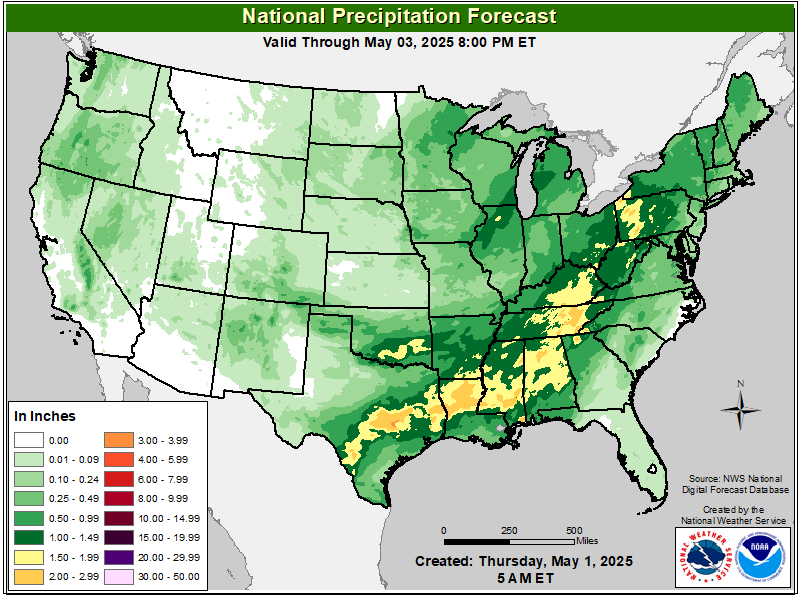
— North-central TX; central OK; southeast KS: Heavy rains and a slight risk of flash flooding Tuesday and Tuesday night. 1-3 inches rainfall possible. I-27, I-35, I-40, I-70 potentially impacted.
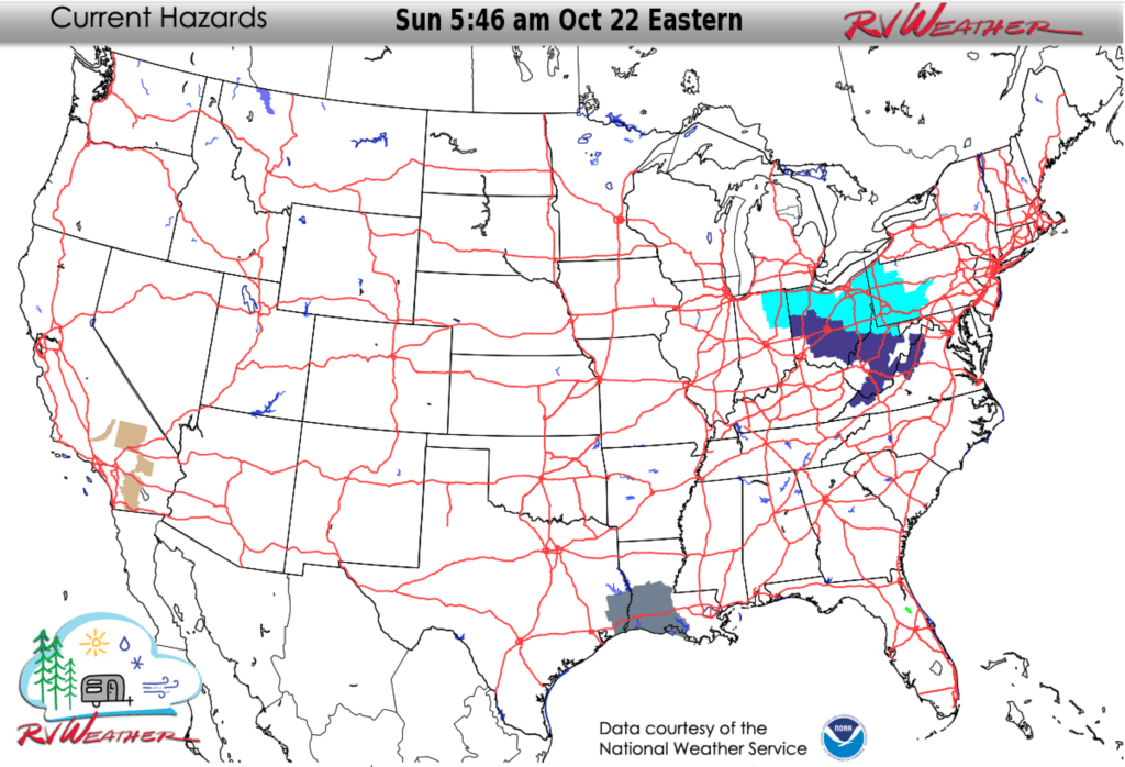
— Southern LA and adjacent southeast TX: Dense Fog Advisory this morning through tonight. I-10, I-12, I-49 impacted.
Eastern:
— Higher terrain of upstate NY and central and eastern PA; western MD; northeast WV: Strong winds this afternoon through late this evening. Gusts 30-35 mph. I-68, I-70, I-76, I-80, I-81, I-84, I-86, I-87, I-88, I-90, I-99, PA Turnpike, NY Thruway impacted.
— Northwest IN; much of OH; much of WV; western PA; northwest VA: Freeze Warnings and Watches for early Monday morning. Low temperatures in the high 20’s and lower 30’s deg F.


Current Severe Thunderstorm and Tornado Watches from the National Weather Service Storm Prediction Center

Two-day tropical weather outlook from the National Hurricane Center

Tornado safety information for RVers (what to do!):
Access to real-time road information:
Phone numbers and websites for road conditions in all 50 states. Courtesy of the Cheyenne WY Weather Forecast Office
Some useful links:
Thank you for using RVWeather.