
- Strong to severe thunderstorms are possible this afternoon across the northern and central High Plains today.
- Heat returns to the West; high temperatures continue through the weekend and well into next week.
- A wet weekend with persistent heavy rain showers and thunderstorms for the Deep South and Southeast.
From the RV Weather Field Office in State College PA:
These are the most significant weather impacts to RV travel over the next two to three days. I do not list every area of rain, showers, or breezy winds. It would be exhausting (for both of us!).
Weather Impacts Pacific Time Zone:
— Much of central and eastern WA and OR; northwest NV; northern ID: A combination of Excessive Heat Warnings, Watches and Advisories through Monday. Hottest days Sunday and Monday. High temperatures 95 – 110 deg F.
— Central CA west of I-5, except on the immediate coast: Heat Advisories today. High temperatures in the upper 90’s and lower 100’s deg F.
— A portion of central CA: Excessive Heat Warning next Monday through Wednesday. High temperatures as high as 113 deg F.
— Southern CA foothills and mountains away from the immediate coast: Heat Advisories through Sunday. High temperatures up to 103 deg F.
— Interior southern CA; and southeast CA interior deserts and east of the Sierra Nevada, including the Mojave Desert and Death Valley National Park; southern NV: Excessive Heat Warnings through Sunday. High temperatures 107 – 118 deg F with temperatures well above 120 deg F in Death Valley NP. I-8, I-10, I-15, I-40, US-395, CA-14, CA-58 impacted.
Weather Impacts Mountain Time Zone:
— Northwest MT: Excessive Heat Warnings and Advisories through Tuesday. High temperatures generally 95-105 deg F.
— Southwest ID along the I-84 corridor: Excessive Heat Warnings and Advisories through Monday. High temperatures 105-110 deg F. I-84, US-26, US-93, US-95 impacted.
— Far-eastern WY; eastern CO: Isolated strong to severe thunderstorms are possible this afternoon. Wind gusts and hail will be the primary hazards. I-70, I-76, I-80, I-90, US-40, US-50, US-287 potentially impacted.
— Portions of southwest UT Zion National Park: Excessive Heat Watch Saturday and Sunday. High temperatures may reach 111 deg F. I-15 impacted.
— Much of western and south-central AZ: Excessive Heat Warnings today and Saturday. High temperatures 110-117 deg F. I-8, I-10, I-17, I-40 impacted.
— Much of central NM: Flood Watches this afternoon through late tonight. Flash flooding may be caused by an increase in the number and intensity of showers and thunderstorms. Rainfall rates may exceed 2 inches per hour. I-25, I-40, US-54, US-60, US-64, US-70, US-84, US-285, US-380 potentially impacted.
Weather Impacts Central Time Zone:
— Southwest and south-central SD; western and central NE; northwest KS: Severe thunderstorms are possible today. Damaging wind gusts and large hail will be the primary hazards. I-70, I-80, US-20, US-36, US-83 potentially impacted.
Weather Impacts Eastern Time Zone:
— Southern and southeast VA; north-central and northeast NC: Isolated strong to severe thunderstorms possible on Saturday. I-40, I-64, I-74, I-77, I-85, I-95 potentially impacted.
— Southern FL: Heat Advisory today. Heat index values 105-110 deg F.
Graphics for Today
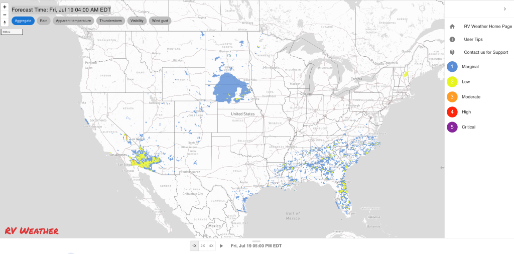


Current Severe Thunderstorm and Tornado Watches from the National Weather Service Storm Prediction Center


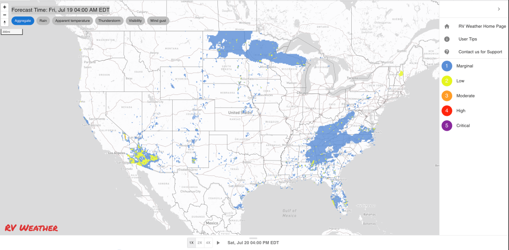
Graphics for Tomorrow


Three-day Summaries


Access to real-time road information:
Phone numbers and websites for road conditions in all 50 states. Courtesy of the Cheyenne WY Weather Forecast Office
Some useful links:
Thank you for using RVWeather.