
- Strong Santa Ana winds over southern Nevada and southern California continue into Monday. Fire danger will be high.
- A snow, sleet and freezing rain mix for the High Plains of Colorado and New Mexico, and from Kansas to western Texas.
- Winter comes calling on the Michigan Upper Peninsula and interior Maine starting tonight.
Delivered to your in-box each morning.
Starting Monday morning, 27 November, this site will be down for a major upgrade. RVWeather.com will return no later than Wednesday 29 November — sooner if possible. When the site returns, WILMA, our NEW(!) integrated weather impacts product, will be available. The Paywall will also be implemented. RV Weather will continue to provide free access to essential, RV-relevant National Weather Service Warnings and Advisories, current weather, and weather safety information. While the main site is off-line, I will post a simple forecast to my email list and to RVWeather on Facebook.
From the RV Weather Winter Office in State College PA:
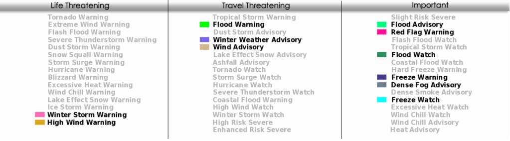
These are the most significant weather impacts to RV travel over the next two to three days. I do not list every area of rain, showers, or breezy winds. It would be exhausting (for both of us!). Please check out the animations and graphics for a good depiction of the weather along your route.
Pacific:
— CA coastal region north of the Bay Area to the OR border: Red Flag (fire danger) Warnings through this evening. Wind gusts 30-50 mph. US-101, CA-1 impacted.
— Much of northern CA west of the Sierras: Wind Advisory through this afternoon. Wind gusts 45-55 mph. Highest wind gusts over the Sierra at higher elevations and through gaps and canyons. I-5, I-80, CA-99 impacted.
— Portions of central CA southern Salinas Valley, San Luis Obispo County interior valleys and the Owens Valley: Freeze Warning Monday morning. Low temperatures in the upper 20’s and lower 30’s.
— Southern NV; southeast CA deserts: Wind Advisories continue through late this evening. Gusts 45-50 mph. I-8, I-10, I-15, I-40, US-93, US-95, US-395 impacted.
— Southern NV / AZ border; northern section CA / AZ border from Lake Mead Recreation Area south to Colorado River Indian Reservation: High Wind Warning continues through early Monday morning. Gusts to 60 mph. I-40, US-93, US-95 impacted.
— Southern CA Coastal Ranges from Santa Barbara County to San Diego County. High Wind Warnings (Santa Ana Mountain) and Wind Advisories continue through Monday night. Wind gusts generally 45-50 mph except 65 mph or higher in the Cajon Pass and Santa Ana Mountains. Strong winds may continue through Wednesday afternoon in the San Diego County Mountains. Major highways impacted include I-5, I-8, I-10, I-15, US-101 and greater Los Angeles roads and freeways.
Mountain:
— South-central and southeast MT; eastern WY along the I-90 / I-25 corridor from Bozeman to Cheyenne: Strong winds Monday morning though early afternoon. Gusts 30-35 mph. I-25, I-90 impacted.
— Southeast UT: Freeze Warning for tonight and Monday morning. Low temperatures in the upper teens.
— Far southwest UT Washington County. Wind Advisory continues through midday today. Wind gusts to 55 mph. I-15 impacted.
— Southwest UT and northwest AZ: Freeze Warnings for Monday morning. Low temperatures upper 20s and lower 30’s.
— Much of central AZ: Freeze Warning Sunday night and Monday morning. Low temperatures mid 20’s to lower 30’s.
— Southeast AZ; southern NM: Freeze Watch Monday night and Tuesday morning. Low temperatures 25-30 degrees.
— West-central, central and southeast AZ; southwest and southeast NM, and adjacent far-west TX: Strong winds tonight through Monday afternoon. Wind gusts 30-45 mph, especially in the mountains. I-10, I-17, I-40 impacted.
— Higher elevations of south-central and southeast WY; much of central and western CO: Winter Storm Warnings (CO) and Advisories (WY) continue through midday today. Additional snow accumulations will range from an inch in the north to 3 inches in the southwest. Wind gusts to 35 mph. I-25, I-70, I-80 impacted.
— Eastern CO; northeast and east-central NM: Winter Weather Advisories continue today. Snow in the north and mixed snow and freezing rain in the south. Additional accumulations of 1-2 inches of snow with up to a 1/10th of an inch of ice in the south. I-70 should see mostly snow. I-40 will see snow, sleet and freezing rain up to 1/2 inch accumulation. Wind gusts to 35 mph. I-40, I-70, I-76 impacted.
— North-central NM Sangre de Cristo Mountains: Winter Weather Advisory midday today through early Monday morning. 2-6 inches of snow likely. Most of this snowfall will be to the west of I-25.
— Central and south-central NM: Wind Advisory tonight. Gusts to 50 mph. I-25, I-40 (around Albuquerque) impacted.
— East-central and southeast NM: Dense Fog Advisories this morning. Some drizzle too. I-40 impacted.
— East-central and southeast NM: Freeze Warning tonight into Monday morning. Low temperatures in the mid 20’s.
Central:
— Central and western SD; northwest NE: Strong winds this afternoon. Wind gusts 30-40 mph. I-90 impacted.
— Western and central KS; western OK: Winter Weather Advisories continue through early this afternoon. A mixture of snow, sleet and freezing rain. Snow accumulations generally 1 inch or less. Ice accumulations may reach 1/10th of an inch. I-35, I-40, I-70 impacted.
— TX Panhandle: Winter Weather Advisories today. A mixture of snow, sleet and freezing rain. Snow accumulations generally 1 inch or less. Ice accumulations may reach 1/10th of an inch. Wind gusts to 35 mph. I-27, I-40 impacted.
— Portions of western TX: Dense Fog Advisory this morning. I-20 impacted.
— Southwest TX Pecos County: Winter Weather Advisory this evening through Monday afternoon. Freezing rain, freezing drizzle and sleet. Up to 1/10th of an inch of ice possible. I-10 impacted.
— Southwest TX: Freeze Watch tonight through Monday afternoon. Temperature in the upper 20’s.
— Southwest TX Guadalupe Pass: High Wind Warning this evening through late Monday morning. Wind gusts to 70 mph.
— Far-west and southwest TX west of the I-10 / I-20 split and along the TX/Mexico border: Strong winds tonight through midday Monday. Wind gusts 35-50 mph. Strongest winds near the TX/NM border. I-10 impacted.
— Portions of central and northeast TX; southeast and east-central OK: Flood Watches and Advisories continue through Monday morning. 1-2 inches of additional rainfall are possible. Major highways potentially impacted include I-20, I-30, I-35, I-40, I-45.
— Central and eastern TX: Strong winds this afternoon, tonight and Monday. Winds start in central and south-central TX and spread to the Gulf Coast by Monday morning. Wind gusts 35-45 mph. Strongest and most prolonged winds around the greater San Antonio region. I-10, I-20, I-35, I-37, I-45 impacted.
— Southern WI; eastern IA; IL; most of MO; southeast KS; most of central and eastern OK: Freeze Warnings and Watches tonight and Monday. Low temperatures in the 20’s.
— Southwest TN, and adjacent northern MS and eastern AR: Dense Fog Advisory through mid-morning. I-22, I-40, I-55 impacted.
— Southeast LA; southern MS; southwest AL; far-western FL Panhandle: Dense Fog Advisories this morning. I-10, I-12, I-55, I-59, I-65 impacted.
Eastern:
— MI Upper Peninsula; northern Lower Peninsula: Snow starts this afternoon and continues through Tuesday. Widespread Accumulations of 2-5 inches with up 8-12 inches on the Keweenaw Peninsula. I-75, US-41 impacted.
— Northern and western ME: Winter Weather Advisory Monday. 3-6 inches snow expected. I-95, US-201 impacted.
— Northeast FL Peninsula; southeast GA: Fog likely Monday morning. I-10, I-16, I-75, I-95 impacted.
— Central and southern IN; much of KY: Freeze Watches Monday night and Tuesday morning. Low temperatures in the upper 20’s.


Current Severe Thunderstorm and Tornado Watches from the National Weather Service Storm Prediction Center

Two-day tropical weather outlook from the National Hurricane Center

Tornado safety information for RVers (what to do!):
Access to real-time road information:
Phone numbers and websites for road conditions in all 50 states. Courtesy of the Cheyenne WY Weather Forecast Office
Some useful links:
Thank you for using RVWeather.