


Planning to travel today or this week? Here’s what could impact your route – and what you should do.
- TORNADO WATCH this morning: Severe storms and tornado risk in the Southeast
- Flash flooding early in west-central Georgia; scattered heavy showers and thunderstorms across much of the Southeast and into the Mid-Atlantic states today
- A few severe storms are possible on Friday from parts of Oklahoma into Missouri. Scattered storms are also likely over much of Texas into the lower Mississippi Valley.
What this means for your trip
- Morning travel through southeast Alabama, the Florida Panhandle, Big Bend Florida, and south Georgia may require delaying departure until the severe-storm threat passes.
- Routes through west-central Georgia should avoid flooded low spots and underpasses early this morning.
- RVers crossing inland North Florida or inland Southeast Georgia should expect reduced visibility from fog and smoke before conditions improve.
- Friday and Saturday travel across parts of the southern Plains may need route or departure-time adjustments around severe storms.
Your route’s weather may vary from the general forecast — check your exact trip
48-hour access • No credit card required
Risk free – 30-day money-back guarantee
Want a deeper look at conditions?
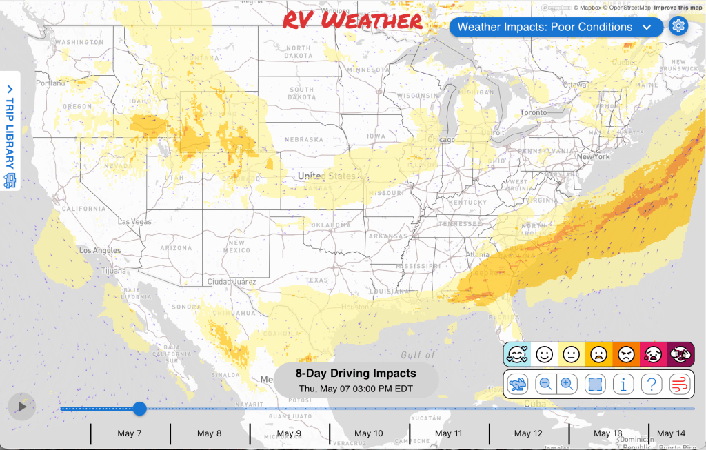
Below are the significant weather alerts and travel impacts across the country for the next 2-3 days.
Check out the extended forecast through May 18th at the end of the short-term forecast.
Weather Impacts Pacific:
No significant weather impacts to RV Travel today or Friday.
Weather Impacts Mountain:
— Southern Idaho, western Wyoming: Strong westerly winds this afternoon. Gusts to 40 mph. Crosswinds on north-south routes. I-15, I-80, I-84 impacted.
Weather Impacts Central:
— Central and eastern Oklahoma, central and southern Missouri, northwest Arkansas, and southeast Kansas: A few severe storms are possible Friday. I-35, I-40, I-44, I-49, I-70, US-54, US-59, US-60, US-62, US-63, US-64, US-65, US-69, US-70, US-71, US-75, US-277, US-281, US-400, US-412 potentially impacted.
— Central and northern Oklahoma, and parts of south-central Kansas: Isolated strong to severe thunderstorms are possible Saturday. I-35, I-40, I-44, US-50, US-54, US-56, US-60, US-64, US-183, US-283, US-400, US-412 potentially impacted.
— Parts of central and southern Texas: Isolated strong to severe storms are possible today, including the lower Rio Grande Valley and deep South Texas, which could create difficult driving for high-profile vehicles in heavier storms. I-2, I-10, I-35, I-37, I-69, I-69C, I-69E potentially impacted.
— Extreme southeast Mississippi, central and southern Alabama, and the Florida Panhandle: Widely scattered severe storms capable of damaging winds and a couple tornadoes are possible today. The greatest risk of severe weather will be across much of Florida Panhandle and parts of central and southern Alabama. I-10, I-65, I-85, US-19, US-27, US-29, US-43, US-49, US-80, US-82, US-84, US-98, US-231, US-280, US-431 potentially impacted.
— Southeast Alabama, the Florida Panhandle, Big Bend Florida, and south Georgia: TORNADO WATCHES continue through this morning, with a couple of intense tornadoes, wind gusts to 70 mph, and hail up to 1.5 inches in diameter all possible. I-10, I-65, US-19, US-27, US-29, US-43, US-84, US-98, US-231, US-431 potentially impacted.
Weather Impacts Eastern:
— West-central Georgia: FLASH FLOOD WARNING early this morning for southern Harris County and northern Muscogee County, where 2 to 3 inches of rain have fallen and another 1 to 2 inches is possible, with flash flooding ongoing or expected to begin shortly in small creeks, urban areas, highways, underpasses, and low-lying areas. US-27 impacted.
— Inland North Florida and inland Southeast Georgia: Dense fog and smoke continue through late morning, with local visibility of one-quarter mile or less through mid-morning and sudden visibility changes possible near low spots, marshes, rivers, creeks, and lakes. I-10, I-75, US-27, US-41, US-84 impacted.
— Northeast and north-central Florida: Red Flag Warning begins around midday and continues through late evening, with west winds 10 to 15 mph, gusts up to 30 mph, relative humidity as low as 27 percent, and temperatures up to 97 degrees; existing or newly ignited wildfires may spread rapidly and become difficult to contain. I-10, I-95, US-1, US-17, US-301 impacted.
— Much of Georgia, much of South Carolina, southeast North Carolina, and northern Florida Peninsula: Widely scattered severe storms capable of damaging winds and a couple tornadoes are possible today, with isolated strong to severe storms also possible in parts of the Carolinas. The greatest risk of severe weather will be across southern Georgia and parts of northern Florida Peninsula. I-10, I-16, I-20, I-26, I-40, I-74, I-75, I-77, I-95 potentially impacted.
Outlook through May 13th:
Friday, May 8 through Tuesday, May 12: much of Michigan Lower Peninsula: Frost or freeze conditions may create cold-weather travel concerns for RV travelers. Major highways potentially affected include I-75.
Sunday, May 10 through Tuesday, May 12: portions of southeastern California and much of southwestern Arizona: Hazardous heat may create challenging travel conditions, especially near higher terrain including San Gorgonio Pass. Major highways potentially affected include I-8, I-10.
Monday, May 11 through Tuesday, May 12: portions of interior central California: Hazardous heat may create challenging travel conditions. Major highways potentially affected include I-5.
Monday, May 11: Much of central and northern Wisconsin: Frost or freeze conditions may create cold-weather travel concerns for RV travelers. Major highways potentially affected include I-94.
Wednesday, May 13: south-central Oklahoma and portions of northern Texas: Hazardous heat may create challenging travel conditions. Major highways potentially affected include I-20, I-30, I-35, I-40.
Extended Outlook May 14th through May 20th:
Thursday, May 14 through Friday, May 15: small portions of southwestern Washington, much of western Oregon, and portions of northwestern California: High winds may develop, which could create hazardous crosswinds for high-profile vehicles. Major highways potentially affected include I-5, I-84.
Thursday, May 14: from southeastern Colorado and eastern New Mexico across Kansas, Oklahoma, and much of Texas: Hazardous heat may develop, which could create challenging travel conditions. Major highways potentially affected include I-20, I-35, I-40.
Thursday, May 14 through Friday, May 15: eastern New Mexico, most of Kansas, most of Oklahoma, and northern and western Texas: High winds may develop, which could create hazardous crosswinds for high-profile vehicles. Major highways potentially affected include I-10, I-20, I-30, I-35, I-40, I-70.
Forecast Confidence for the Extended Outlook:
Confidence is average in the earlier period, with decent agreement on the large-scale pattern but some uncertainty in smaller systems. Confidence decreases to below average later, as model differences increase, especially in the larger-scale pattern and related temperature and precipitation details.
Looking for real-time road conditions? Here’s a link, courtesy of the Federal Highway Administration, to all the individual State 511 websites.
Your route’s weather may vary from the general forecast — check your exact trip
48-hour access • No credit card required
Risk free – 30-day money-back guarantee
Selected travel-relevant Weather Graphics


Graphics for Today


Current Severe Thunderstorm and Tornado Watches from the National Weather Service Storm Prediction Center


Hail Size Forecast for today and tomorrow

Wildfire Smoke Forecast for today and tomorrow

Graphics for Tomorrow


National Weather Map for the Day after Tomorrow

Three-day Summaries


Day 3 – Day 7 U.S. Significant Weather Outlook

Access to real-time road information:
Phone numbers and websites for road conditions in all 50 states. Courtesy of the Cheyenne WY Weather Forecast Office
Some useful links:
Thank you for using RVWeather.