
- Hot conditions across much of the West for the 4th of July holiday and into next week. Fire danger will be on the increase. Hot today also along the I-95 corridor in the Northeast, the Lower Mississippi Valley, and much of Florida.
- Severe weather, torrential rainfall, and flash flooding is likely for southern Missouri and the lower Ohio Valley.
- Category 3 Hurricane Beryl is passing south of the Cayman Islands. Landfall along the northern Mexican coast, possibly close to the Texas border, is likely late Sunday. Anyone living in or traveling to the southern Texas coast this weekend should pay attention to the National Hurricane Center warnings on Beryl.
From the RV Weather Field Office in State College PA:
These are the most significant weather impacts to RV travel over the next two to three days. I do not list every area of rain, showers, or breezy winds. It would be exhausting (for both of us!).
Weather Impacts Pacific Time Zone:
— Portions of western and coastal CA from north of San Francisco to Santa Barbara: Red Flag (fire danger) Warnings through Saturday. Although wind gusts should be less than 30 mph, hot temperatures and very low relative humidities greatly increase the fire danger. I-5 (Grapevine), US-101, CA-1 impacted.
— WA; northern ID; much of OR; most of CA; western, central and southern NV: A combination of Excessive Heat Warnings, Watches and Advisories extend through the extended Holiday Weekend and well into next week. High temperatures will range from the 90’s across WA, to lower 100’s for much of OR, to 100-115 deg for large portions of CA away from the immediate coat. Temperatures in Death Valley will range from 125-130 deg F.
Weather Impacts Mountain Time Zone:
— Northern, central and southwest ID; northwest MT: Excessive Heat Watches Monday through Wednesday. High temperatures will range from the 90’s in MT to the lower 100’s in southwest ID.
— Portions of southwest WY; north-central and central CO: Strong winds this afternoon and evening. Wind gusts up to 30 mph. I-70, I-80, US-40, US-50 impacted.
— Portions of southwest ID; portions of west-central and southwest WY: Strong winds Friday afternoon. Wind gusts to 30 mph. I-80, I-84, US-20, US-26 impacted.
— South-central UT Glen Canyon Recreation Area, Lake Powell, Zion National Park: Excessive Heat Warnings Sunday and Monday. Temperatures up to 110 deg F.
— South-central and western AZ including the Phoenix metro area: Excessive Heat Warnings (northwest AZ) and Watches through Tuesday. Afternoon temperatures 109-118 deg F. Temperatures may reach 120 deg F in the Colorado Valley.
— AZ Grand Canyon below 4000 feet: Excessive Heat Warning through Monday. Temperatures reaching 113 deg F.
— Far southwest EX including El Paso: Heat Advisory today. High temperatures 103-105 deg F.
Weather Impacts Central Time Zone:
— Portions of western and south-central SD; portions of western NE: Strong winds this afternoon. Gusts 30-35 mph. I-90, US-18, US-20, US-83 impacted.
— Southern MN; northern IA; west-central WI: Severe thunderstorms possible today. I-35, I-90, I-94 potentially impacted.
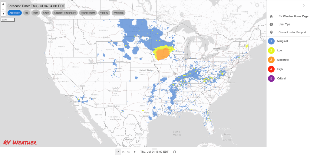
— Southwest, central and northeast OK; southeast KS; central and southern MO; northern AR: Severe thunderstorms possible today. I-35, I-40, I-44, I-55 potentially impacted.
— Southern SD; NE; northern, western and central KS; OK and TX Panhandles: There is the potential for severe thunderstorms on Saturday. I-27, I-29, I-35, I-40, I-70, I-80, I-90 potentially impacted.
— Eastern KS; much of central and southern MO; southern IL; southwest IN: FLASH FLOOD WARNINGS and Flood Watches from a series of heavy rain showers and thunderstorms, bringing intense rainfall rates. Widespread rainfall amounts of 2-3 inches, with localized amounts up to 6 inches. I-44, I-55, I-57 I-64, I-70 impacted.
— Much of central and eastern OK; north-central and eastern TX; southern MO; AR; most of LA; western KY; western and central TN; MS; most of AL; FL Panhandle: Excessive Heat Warnings and Advisories today. Heat index values around 110 deg F will be common. I-20, I-22, I-30, I-40, I-44, I-49, I-55 impacted by the Excessive Heat Warnings.
— South TX Coast: Monitor the progress of Hurricane Beryl. Beryl may impact the south TX coast starting Sunday with heavy rains, some wind and storm surge. Know where and how to get reliable emergency management information for your campground or location. Please follow local Emergency Management guidance and recommendations.
Weather Impacts Eastern Time Zone:
— Southern IN; KY; central and northern TN; southern and eastern OH; northwest PA: Strong to marginally severe thunderstorms possible today. A few damaging winds gusts will be the primary hazard. I-24, I-64, I-65, I-69, I-70, I-71, I-75, I-76, I-77, I-79, I-80, PA and OH Turnpikes potentially impacted.
— Central, eastern and southern OH; far-western PA; western and central WV; eastern KY: Marginally severe thunderstorms likely on Friday. Wind gusts are the primary hazard. I-64, I-70, I-71, I-75, I-76, I-77, I-80, I-90, PA and OH Turnpikes potentially impacted.
— I-95 corridor from Trenton NJ south to Fredericksburg VA, including Philadelphia, Baltimore, Washington DC; much of the MD Eastern Shore; DE: Heat Advisories today and Friday. Heat index values 100-107 deg F.
— Much of northern and central GA: Heat Advisories today. Heat index values as high as 109 deg F.
— Most of FL except for northeastern corner: Heat Advisories today. Expect heat index values 105-110 deg F.
Graphics for Today


Current Severe Thunderstorm and Tornado Watches from the National Weather Service Storm Prediction Center


Graphics for Tomorrow


Three-day Summaries


Access to real-time road information:
Phone numbers and websites for road conditions in all 50 states. Courtesy of the Cheyenne WY Weather Forecast Office
Some useful links:
Thank you for using RVWeather.