
- Beryl’s remnants have departed the US, but not before dropping several tornadoes, damaging wind gusts, and 2-6 inches of rain across upstate New York and northern New England yesterday.
- The East gets a brief break in the heat, but the Heat Wave continues through the weekend across the West.
- Heat spreads onto the High Plains this weekend.
From the RV Weather Field Office in State College PA:
These are the most significant weather impacts to RV travel over the next two to three days. I do not list every area of rain, showers, or breezy winds. It would be exhausting (for both of us!).
Weather Impacts Pacific Time Zone:
— Southern and west-central OR; most of CA and NV: A combination of Excessive Heat Warnings, Watches and Advisories continue into the weekend. High temperatures will range from the 90’s and lower 100’s for southern OR, to 100-115 deg for large portions of CA away from the coast. Temperatures in Death Valley will range from 125-130 deg F.
Weather Impacts Mountain Time Zone:
— Portions of southern and southeast ID: Red Flag (fire danger) Warnings this afternoon and evening. Wind gusts to 30 mph. I-15, I-84, I-86, US-20, US-26, US-93 impacted.
— Much of central and eastern MT; central and north-central WY: Heat Advisories today and Friday. High temperatures 95-105 deg F.
— Northeast MT: Isolated strong to possibly severe thunderstorms may produce a damaging wind gust or two this afternoon and evening. I-94, US-2 potentially impacted.
— Far-eastern MT: A couple of instances of severe gusts associated with thunderstorms are possible Friday. I-94, US-2 potentially impacted.
— Much of southern ID and UT; western and parts of central and southern AZ: A combination of Excessive Heat Warnings and Advisories are in effect into the weekend. High temperatures will range from the 90’s in MT and northern ID, to the 107 deg F in western UT, to 118 deg F in the AZ deserts.
— Much of CO along the I-25 corridor: Heat Advisories Friday through Sunday. High temperatures will be in the upper 90’s and lower 100’s deg F.
— South-central UT Glen Canyon Recreation Area, Lake Powell, Zion National Park: Excessive Heat Warnings through Friday. Temperatures between 100-115 deg F.
— AZ Grand Canyon below 4000 feet: Excessive Heat Warning through Friday. Temperatures reaching 115 deg F.
— South-central AZ: Strong to isolated severe thunderstorms may produce damaging wind gusts this afternoon and evening. I-8, I-10, I-17, I-19 potentially impacted.
Weather Impacts Central Time Zone:
— Far-western ND; western SD; western NE: Strong to marginally severe thunderstorms may produce some wind gusts or hail this afternoon or evening. I-80, I-90 potentially impacted.
— Western and northern ND; western SD; northwest NE: A couple of instances of severe wind gusts and perhaps hail are possible Friday. I-90, I-94, US-2, US-12, US-18, US-20, US-85 potentially impacted.
— Northern, central and eastern ND; northeast SD; MN; northwest WI: Some clusters of strong to severe thunderstorms may form on Saturday. I-29, I-35, I-90, I-94 potentially impacted.
— Southwest NE: Excessive Heat Watch Friday through Monday. Heat index values around 100 deg F. I-80 impacted.
— Portions of southeast TX: Heat Advisories today. Heat index values may reach 106 deg F.
— Parts of western TN and northeast MS: Dense Fog Advisory this morning. I-40 impacted.
Weather Impacts Eastern Time Zone:
— Southwest MD; northeast IN and adjacent northwest OH: Dense Fog Advisories this morning. I-69, I-80, I-90, I-94, I-96, I-196, US-131 impacted.
— NY eastern Adirondack Mountains and Champlain Valley; northern VT and NH; much of ME north and west of I-95: FLASH FLOOD WARNINGS, FLOOD WARNINGS, Advisories and Watches continue this morning. 2-6 inches of rain have fallen over this region. While additional rainfall amounts over this region will be 1/2 inch or less, flooding of rivers, creeks, streams, and other low-lying and flood-prone locations is imminent or occurring. Numerous roads are closed due to flooding. I-87, I-89, I-91, I-93, I-95, US-2 potentially impacted.
— Coastal NH; northeast MA: Heat Advisories today. Heat index values in the upper 90’s deg F.
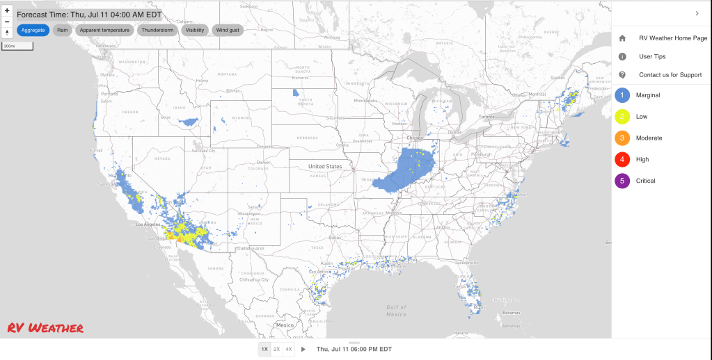
Graphics for Today


Current Severe Thunderstorm and Tornado Watches from the National Weather Service Storm Prediction Center


Graphics for Tomorrow


Three-day Summaries


Access to real-time road information:
Phone numbers and websites for road conditions in all 50 states. Courtesy of the Cheyenne WY Weather Forecast Office
Some useful links:
Thank you for using RVWeather.