
- Significant Lake Effect snow continues through Wednesday morning.
- Extensive fog and freezing fog this morning for the Pacific Northwest.
- Some severe thunderstorms possible southeast Texas on Thursday.
Delivered to your in-box each morning. You need a subscription to access the forecast.
From the RV Weather Home Office in Reston VA:
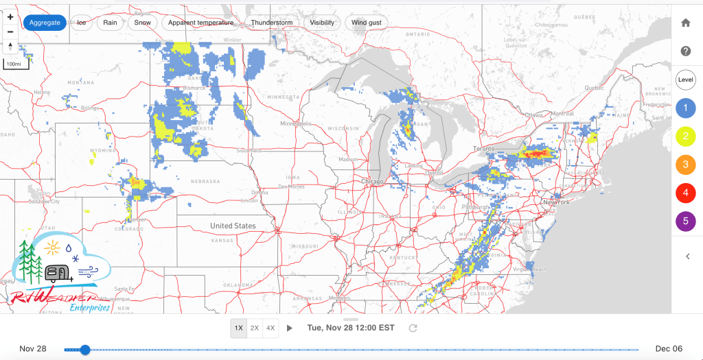
These are the most significant weather impacts to RV travel over the next two to three days. I do not list every area of rain, showers, or breezy winds. It would be exhausting (for both of us!). Please check out the animations and graphics for a good depiction of the weather along your route.
Pacific:
— Northwest OR and southwest WA lower Columbia Gorge: Strong winds today. Wind gusts 35-45 mph. I-84 impacted.
— Portions of southeast WA and adjacent north-central OR: Freezing Fog Advisory through midday today. I-84, US-395 impacted.
— Portions of northwest, central and southeast CA; southern NV: Freeze and Hard Freeze Warnings in effect for the first part of the week. Low temperatures in the 20’s.
— Southern CA Santa Monica, Ventura Country, and San Gabriel Mountains, including the I-5 corridor north of Los Angeles: Wind Advisory through this afternoon. Gusts to 50 mph. I-5, CA-14 impacted.
— Southeast CA along the AZ-NV Colorado Basin border: Strong winds today. Gusts to 45 mph. I-40 impacted.
Mountain:
— Northwest MT Rocky Mountain Front: Strong winds today and Tuesday. Wind gusts to 45 mph. Strongest winds this evening. US-2 impacted.
— South-central MT Bozeman Pass and Livingston area: Strong winds midday today through early Tuesday morning. Gusts 35-45 mph. I-90 impacted.
— Southeast WY north of Cheyenne: High Wind Warning this evening through Tuesday afternoon. Gusts to 60 mph. I-25, I-80 impacted.
Central:
— Much of ND; northern and western SD: Strong winds late Tuesday morning through Tuesday evening. Wind gusts 30-40 mph. I-90, I-94 impacted.
— Western SD Black Hills: Strong winds today. Gusts to 40 mph. I-90 impacted.
Eastern:
— MI Upper Peninsula; northern MI Lower Peninsula: Winter Storm Warnings and Advisories through Tuesday morning. Additional snow accumulations of 3-10 inches and wind gusts 30-40 mph. I-75, US-2, US-31, US-41 impacted.
— Northeast OH; northwest PA; western NY downwind of Lake Erie: Lake Effect Snow Warnings and Winter Weather Advisories in effect through early Wednesday morning. 5-12 inches of snow and wind gusts to 35 mph. I-71, I-77, I-79, I-80, I-86, I-90, NY Thruway, OH Turnpike impacted.
— Western and northern NY downwind of Lake Ontario: Lake Effect Snow Warnings and Winter Weather Advisories in effect through early Wednesday morning. Up to 1-2 feet of snow possible, especially on the Tug Hill Plateau. Wind gusts to 35 mph. I-81, I-87, I-90, NY Thruway impacted.
— Northern VT; northern NH; interior ME: Winter Weather Advisory continues through this afternoon. Wet snow, mixing with rain,. Additional accumulations will range from 1-2 inches in the valleys to 3-6 inches at higher elevations. I-93, US-2, US-201 impacted.
— Coastal NH; eastern ME: High Wind Warnings and Advisories through midday today. Wind gusts 50-65 mph. Strongest winds confined to the immediate coast. I-95, US-1 impacted.
— Far-western MD; portions of northeast WV; portions of west-central and southwest VA; far-northwest NC: Wind Advisories this afternoon through Tuesday afternoon. Gusts to 50 mph. Strongest winds late tonight. I-64, I-68, I-77, I-81, US-220 impacted.
— Central and south-central PA: Strong winds today and Tuesday. Gusts 30-40 mph. Strongest winds Tuesday morning. I-70, I-76, I-80, I-81, I-99, PA Turnpike impacted.
— Southeast SC and adjacent southeastern GA: Freeze Watch Tuesday night and Wednesday morning. Low temperatures in the upper 20’s to around freezing on the coast.


Current Severe Thunderstorm and Tornado Watches from the National Weather Service Storm Prediction Center

Two-day tropical weather outlook from the National Hurricane Center

Access to real-time road information:
Phone numbers and websites for road conditions in all 50 states. Courtesy of the Cheyenne WY Weather Forecast Office
Some useful links:
Thank you for using RVWeather.