


Planning to travel this week? Here’s what could impact your route.
- Flash Flooding and Severe Storms threaten major Southern Plains travel corridors today
- Western Fire Weather and strong crosswinds build Friday into the weekend
- Severe Storms target the Ohio Valley, Appalachians, and interior Northeast late today into Friday
Your route’s weather may vary from the general forecast — check your exact trip
48-hour access • No credit card required
Risk free – 30-day money-back guarantee
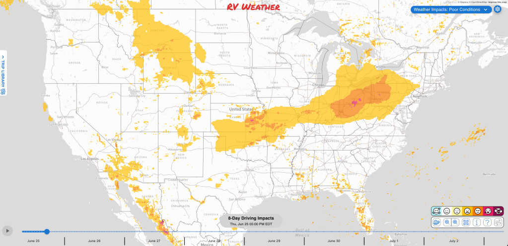
Significant travel weather for the next 2-3 days.
NEW: Extended forecast for the next 2 weeks now included!
Weather Impacts Pacific
— Central and eastern Washington into north-central Oregon: Red Flag Warnings today, with gusts up to 25 to 35 mph and fast fire spread possible. I-82, I-84, I-90, US-2, US-12, US-26, US-97, US-395 impacted.
— Western Nevada basins and the northern Sierra Front: Red Flag Warnings Friday and Saturday, with gusts up to 45 mph. I-80, US-6, US-50, US-95, US-395 impacted.
— Southern Nevada, southeast California deserts, the Lower Colorado River Valley, Lake Mead, Death Valley, the Mojave Desert, and adjacent northwest Arizona: Red Flag Warnings Friday and Saturday, with winds 20 to 30 mph and gusts to 40 to 50 mph. I-8, I-10, I-11, I-15, I-40, US-6, US-60, US-93, US-95, US-395 impacted.
— San Diego County deserts, Imperial Valley, Yuma area, Parker Valley, Central La Paz, and Palo Verde Valley: Extreme Heat Warnings continue through late evening, with temperatures up to 110 in the hottest desert areas. I-8 iimpacted.
Weather Impacts Mountain:
— Southeast Idaho Caribou Range and Snake Plain: Red Flag Warning today and Friday, with gusty winds in the mountains and gusts near 30 mph in the Snake Plain. I-15, I-84, I-86 impacted.
— Southeastern Montana, eastern Wyoming, and eastern Colorado: Isolated severe storms capable of large hail and severe wind gusts are possible Friday afternoon into Friday night. I-25, I-70, I-76, I-80, I-90, I-94 potentially impacted.
— Eastern Montana and adjacent northern Wyoming: Severe thunderstorms are likely Saturday, with the stronger storm risk focused over eastern Montana. I-90, I-94, US-2, US-12, US-14, US-16, US-85, US-87, US-191, US-212 potentially impacted.
— Central and southeast Wyoming, eastern Colorado, and eastern New Mexico: Severe thunderstorms are possible late this afternoon into tonight, with organizing clusters capable of strong to severe wind gusts. The greatest risk of severe weather will be across southeastern Colorado. I-25, I-40, I-70, I-76, I-80, US-18, US-20, US-24, US-26, US-30, US-34, US-36, US-40, US-50, US-54, US-56, US-60, US-62, US-64, US-70, US-82, US-84, US-85, US-87, US-160, US-191, US-285, US-287, US-380, US-385, US-400, US-412 potentially impacted.
— Parts of north-central and northwestern Utah: Isolated strong to severe storms are possible late this afternoon into tonight, mainly with strong to severe wind gusts. I-15, I-80, US-6, US-50, US-89 potentially impacted.
— Most of Utah: Red Flag Warnings Friday through Sunday, with gusts up to 45 to 55 mph. I-15, I-70, I-80, I-84, US-6, US-40, US-50, US-89, US-163, US-191 impacted.
— Western and southwest Colorado: Red Flag Warnings Friday, with gusts up to 50 to 55 mph. I-70, US-40, US-50, US-160, US-491, US-550 impacted.
— Northeast Colorado, Yuma County: Flood Warning continues through afternoon, with 2 to 4 inches of rain already fallen and additional rainfall up to 1 inch possible. US-34 impacted.
— Eastern Colorado, southwest Nebraska, and northwest Kansas Tri-State area: Flood Watch continues through Friday morning after multiple days of heavy rainfall saturated soils, and with additional rainfall expected tonight through Thursday. I-70, US-6, US-24, US-34, US-36, US-83, US-283, US-385 potentially impacted.
— Northern and central Arizona: Red Flag Warnings Friday and Saturday, with winds 20 to 30 mph and gusts 40 to 55 mph. I-17, I-40, US-60, US-89, US-89A, US-93, US-160, US-163, US-180, US-191 impacted.
— Southeast Arizona: Red Flag Warnings Friday through Sunday, with gusts 35 to 40 mph. I-10, I-19, US-60, US-70, US-191 impacted.
— Parts of southern Arizona, including the Phoenix and Tucson metro valleys: Extreme Heat Warnings continue through late this evening. High temperatures will range from 106-113 deg F. I-8, I-10, US-60, US-70, US-95 impacted.
Weather Impacts Central:
— Parts of northwest Kansas: FLASH FLOOD WARNING through this afternoon for Gove County. Between 1.5 and 3.5 inches of rain have fallen. Additional rainfall amounts up to 2 inches are possible in the warned area. I-70 impacted.
— Parts of Northeast Oklahoma: FLASH FLOOD WARNING continues this morning, with 1 to 2 inches of rain already fallen and another 1 to 2 inches possible in the warned area. I-44, US-69, US-75, US-412 impacted.
— Southwest Arkansas: FLASH FLOOD WARNING continues this morning for the Clark and Hot Spring County area, with 1 to 3 inches of rain already fallen, and rainfall rates of 1 to 2 inches in 1 hour expected. US-70 impacted.
— North Dakota, northwestern Minnesota, and much of South Dakota: Severe thunderstorms are likely Saturday, The greatest risk of severe weather will be across central and western North Dakota. I-29, I-90, I-94, US-2, US-10, US-12, US-14, US-52, US-53, US-59, US-71, US-81, US-83, US-85, US-212, US-281 potentially impacted.
— North-central Minnesota and much of the Minnesota Arrowhead: Dense Fog Advisory this morning, with visibility around one quarter mile and hazardous low-visibility driving. US-2, US-53, US-71, US-169 impacted.
— Western South Dakota, western Nebraska, western and southern Kansas, much of Oklahoma and Missouri, southern Illinois, western Kentucky and Tennessee, northern Arkansas, and the Texas Panhandle: Isolated severe storms are possible Friday afternoon into Friday night, with large hail and severe wind gusts the primary hazards. I-24, I-27, I-35, I-40, I-44, I-49, I-55, I-57, I-64, I-65, I-69, I-70, I-76, I-80, I-90 potentially impacted.
— Northern Nebraska Panhandle: Flash Flood Watch continues through Friday morning for the South Fork Burn Scar Area and downstream areas along Soldier Creek, where flash flooding and debris flows remain possible. US-20, US-385 potentially impacted.
— Parts of southwest Nebraska and northwest Kansas: Flood Warnings continue through this afternoon, with 2 to 4.5 inches of rain already fallen and up to 1 inch of additional rainfall possible. I-70, US-6, US-34, US-36, US-83 impacted.
— Most of Kansas: Flood Watches and Advisories continue today and Friday, with widespread additional rainfall of 1 to 2 inches today. I-35, I-70, US-50, US-54, US-56, US-59, US-77, US-83, US-400 potentially impacted.
— Most of Kansas, much of Oklahoma and Missouri, southern Illinois, northern Arkansas, and northwest Texas: Severe thunderstorms are possible late this afternoon into tonight, including damaging wind, large hail, the chance for a tornado. I-20, I-24, I-27, I-29, I-35, I-40, I-44, I-49, I-55, I-57, I-64, I-69, I-70, I-72 potentially impacted.
— Southeast Kansas, central and southern Missouri, and southern Illinois: Flood Watches this afternoon through Saturday, with bands of heavy rainfall around 2 to 4 inches and localized amounts up to 6 inches. I-24, I-29, I-35, I-44, I-49, I-55, I-57, I-64, I-69, I-70 potentially impacted.
— Much of northern and eastern Oklahoma: Flood Watches today and Friday. Heavy rainfall rates of 1 to 2 inches per hour are likely in additional to the 3 to 6 inches of rain already fallen. I-35, I-40, I-44, US-60, US-64, US-69, US-75, US-183, US-412 potentially impacted.
— Southeast Oklahoma, southwest Arkansas, and north-central Louisiana: Flood Watches continue today, with 1 to 2 inches of additional rainfall possible and isolated higher amounts. I-20, I-30, I-49, US-59, US-63, US-67, US-70, US-71, US-79, US-82, US-165, US-167 potentially impacted.
— Far west Texas and Big Bend/Rio Grande Valley areas: Heat Advisories today, with temperatures ranging from105 to 113 deg F in the Presidio Valley, Lower Brewster County, and Rio Grande Valley.
— Southern Iowa, central and southern Illinois, the northeastern half of Missouri, western Kentucky, central Tennessee: Isolated strong to severe storms are possible Saturday. I-24, I-29, I-35, I-40, I-44, I-55, I-57, I-59, I-64, I-65, I-69, I-70, I-72, I-74, I-75 potentially impacted.
— Northwest, west-central, and northeast Illinois into northwest Indiana: Locally dense fog this morning, with visibilities down to one quarter mile, especially in low-lying areas. I-39, I-55, I-57, I-65, I-80, I-88, I-90, I-94 impacted.
— Southern Illinois, southern Missouri, and much of western Kentucky: Flash flooding is possible Friday into Saturday morning, with 2+ inches of additional rain possible as heavy rain shifts through the Mid-Mississippi and Ohio Valleys. I-24, I-44, I-49, I-55, I-57, I-64, I-65, I-69, I-70 potentially impacted.
— Northeast Louisiana and much of central and south-central Mississippi: Dense Fog Advisories through late this morning, with visibility as low as one quarter mile and hazardous low-visibility driving. I-20, I-55, I-59, US-45, US-49, US-61, US-65, US-84, US-98, US-425 impacted.
Weather Impacts Eastern:
— Eastern Michigan, southern Indiana and adjacent northern Kentucky, most of Ohio, western and northern West Virginia, far-western Maryland, western and central Pennsylvania, and southwestern and central New York: Isolated severe storms are possible late this afternoon into tonight, with strong to severe wind gusts, hail, and some potential for tornadoes. I-64, I-65, I-68, I-69, I-70, I-71, I-74, I-75, I-76, I-77, I-79, I-80, I-81, I-86, I-88, I-90, I-94, I-99 potentially impacted.
— Parts of northern Michigan Lower Peninsula: Flood Advisories this morning, with 1 to 2 inches of rain having fallen, and up to 0.5 inch of additional rainfall expected. I-75 impacted.
— Southern Indiana and western and central Kentucky: Isolated severe storms are possible Friday afternoon into Friday night, with severe wind gusts the primary hazard. I-64, I-65, I-69, I-70, I-71, I-74, I-75 potentially impacted.
— Southwest Indiana: Flood Watch begins early evening and continues through Saturday morning, with 1 to 3 inches of rainfall expected and locally higher amounts possible. I-69, I-70 potentially impacted.
— Southwest Indiana, much of Kentucky, central and eastern Tennessee, most of Virginia, North Carolina, South Carolina, and northern and eastern Georgia: Isolated strong to severe storms are possible Saturday. I-16, I-20, I-24, I-26, I-40, I-59, I-64, I-65, I-69, I-70, I-71, I-73, I-74, I-75, I-77, I-81, I-85, I-87, I-95 potentially impacted.
— Much of West Virginia and eastern Kentucky: Flash flooding is possible Saturday into Sunday morning as the Ohio Valley remains in a heavy-rain setup. I-64, I-75, I-77, I-79, US-19, US-23, US-25E, US-27, US-33, US-50, US-52, US-58, US-60, US-68, US-119, US-460 potentially impacted.
— Southeastern Maine, much of New Hampshire and Vermont, Massachusetts and adjacent northern Connecticut, Rhode Island, and portions of eastern New York: Isolated severe storms capable of large hail and severe wind gusts are possible Friday afternoon into Friday night. I-84, I-87, I-88, I-89, I-90, I-91, I-93, I-95 potentially impacted.
Outlook Saturday June 27th through Wednesday July 1st:
— Saturday, June 27 through Monday, June 29: much of the West from eastern California and the Great Basin into the central Rockies: Strong winds may create hazardous crosswinds for high-profile vehicles, especially over higher terrain including Donner Pass, Cajon Pass, Parleys Summit, and Eisenhower Tunnel. Major highways potentially affected include I-15, I-25, I-40, I-70, I-76, I-80, I-84, I-90.
— Saturday, June 27: portions of the Southwest and central Rockies: Wildfire concerns may create smoke, visibility, or wildfire-related travel concerns. Major highways potentially affected include I-15, I-40, I-70.
— Saturday, June 27: most of North Dakota: Heavy rain may create localized flooding and reduced visibility. Major highways potentially affected include I-29, I-94.
— Saturday, June 27 through Wednesday, July 1: from the southern High Plains and Texas into the Lower Mississippi Valley and Southeast: Heat concerns may create challenging conditions. Major highways potentially affected include I-4, I-10, I-20, I-25, I-30, I-35, I-40, I-55, I-64, I-65, I-74, I-75, I-85, I-87, I-95.
— Sunday, June 28 through Monday, June 29: much of Oregon and small portions of western Idaho: Frost or freeze concerns may create challenging conditions. Major highways potentially affected include I-84.
— Sunday, June 28 through Monday, June 29: portions of southeastern Idaho, northeastern Nevada, northern Utah, and southwestern Wyoming: Frost or freeze concerns may create challenging conditions. Major highways potentially affected include I-15, I-80, I-84.
— Sunday, June 28 through Tuesday, June 30: much of Idaho and portions of southwestern Montana: Frost or freeze concerns may create challenging conditions. Major highways potentially affected include I-15, I-84, I-90.
— Sunday, June 28 through Wednesday, July 1: portions of southeastern Idaho, small portions of southern Montana, and much of northwestern Wyoming: Frost or freeze concerns may create challenging conditions. Major highways potentially affected include I-90.
— Sunday, June 28 through Wednesday, July 1: from the central Plains and Upper Midwest into the Mississippi Valley, Ohio Valley, Tennessee Valley, and parts of the Southeast: Heat concerns may create challenging conditions. Major highways potentially affected include I-20, I-29, I-35, I-40, I-55, I-64, I-65, I-70, I-71, I-74, I-75, I-80, I-85, I-90, I-94.
— Monday, June 29: much of central and northern Florida and southern Georgia: Heavy rain may create localized flooding and reduced visibility. Major highways potentially affected include I-4, I-10, I-75, I-95.
— Tuesday, June 30 through Wednesday, July 1: from the Great Lakes and Ohio Valley into the central Appalachians and Northeast: Heat concerns may create challenging conditions. Major highways potentially affected include I-40, I-64, I-70, I-71, I-74, I-75, I-76, I-79, I-80, I-81, I-85, I-90, I-94, I-95.
Extended Outlook July 2nd through July 8th:
— Thursday, July 2 through Saturday, July 4: small portions of southwestern Oregon and coastal California north of San Francisco: Strong winds may develop, which could create hazardous crosswinds for high-profile vehicles. Major highways potentially affected include US-101, CA-1.
— Thursday, July 2 through Friday, July 3: from the Great Lakes and Ohio Valley into Tennessee, West Virginia, Pennsylvania, and New York: Extreme heat is expected, which may create challenging travel conditions. Major highways potentially affected include I-40, I-55, I-64, I-65, I-70, I-71, I-74, I-75, I-76, I-79, I-80, I-90, I-94.
— Thursday, July 2 through Saturday, July 4: eastern Georgia and the Carolinas into Virginia, Maryland, Delaware, and District of Columbia: Extreme heat is expected, which may create challenging travel conditions. Major highways potentially affected include I-20, I-40, I-64, I-70, I-74, I-85, I-87, I-95.
— Thursday, July 2 through Saturday, July 4: from the northern and central Plains through Texas, the Mississippi Valley, Tennessee Valley, Southeast, Mid-Atlantic, and Northeast: Extreme heat is likely, which may create challenging travel conditions. Major highways potentially affected include I-20, I-29, I-30, I-35, I-40, I-55, I-64, I-65, I-70, I-74, I-75, I-76, I-79, I-80, I-81, I-84, I-85, I-87, I-90, I-94, I-95.
— Thursday, July 2 through Sunday, July 5: from the northern Plains and Upper Midwest southward through Texas, the Lower Mississippi Valley, Southeast, and Florida: Extreme heat may develop, which could create challenging travel conditions. Major highways potentially affected include I-4, I-10, I-20, I-25, I-29, I-35, I-40, I-55, I-65, I-70, I-75, I-76, I-80, I-85, I-90, I-94, I-95.
— Thursday, July 2 through Sunday, July 5: from the southern Appalachians into the central Appalachians and interior Northeast: Extreme heat may develop, which could create challenging travel conditions. Major highways potentially affected include I-40, I-64, I-70, I-76, I-80, I-81, I-84, I-87, I-90, I-95.
Forecast Confidence for the Extended Outlook:
Confidence is generally stronger earlier in the outlook, with good agreement on the large-scale pattern. Confidence decreases somewhat later because the pattern becomes more transitional, especially across the western U.S., and precipitation signals are weaker.
Looking for real-time road conditions? Here’s a link, courtesy of the Federal Highway Administration, to all the individual State 511 websites.
Your route’s weather may vary from the general forecast — check your exact trip
48-hour access • No credit card required
Risk free – 30-day money-back guarantee
Selected travel-relevant Weather Graphics


Graphics for Today


Current Severe Thunderstorm and Tornado Watches from the National Weather Service Storm Prediction Center


Hail Size Forecast for today and tomorrow

Wildfire Smoke Forecast for today and tomorrow

Graphics for Tomorrow


National Weather Map for the Day after Tomorrow

Three-day Summaries


Day 3 – Day 7 U.S. Significant Weather Outlook

Access to real-time road information:
Phone numbers and websites for road conditions in all 50 states. Courtesy of the Cheyenne WY Weather Forecast Office
Some useful links:
Thank you for using RVWeather.