RV Weather User Guide

SureRoute® helps RVers plan the safest single and multi-day custom route based on weather impacts to driving conditions like wind, snow, visibility, and more — up to 8 days out.

Overview of SureRoute® interface highlighting features for planning RV trips, including weather impacts, route options, and advisory mode.
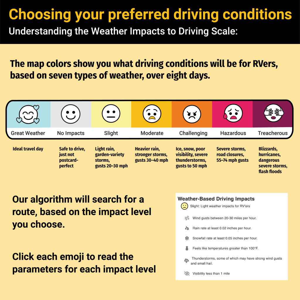
Infographic showing preferred driving conditions for RVers based on weather impacts, featuring a color-coded scale from great weather to treacherous conditions, along with descriptions of each impact level.
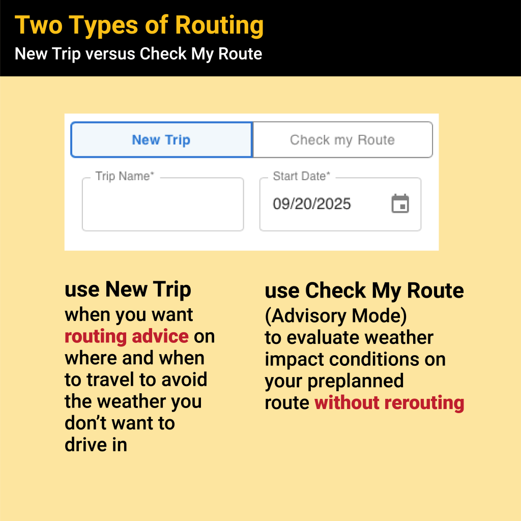
Graphic showing two types of routing options in the SureRoute® app: 'New Trip' for route planning to avoid adverse weather, and 'Check My Route' for checking weather impacts on a preplanned route.
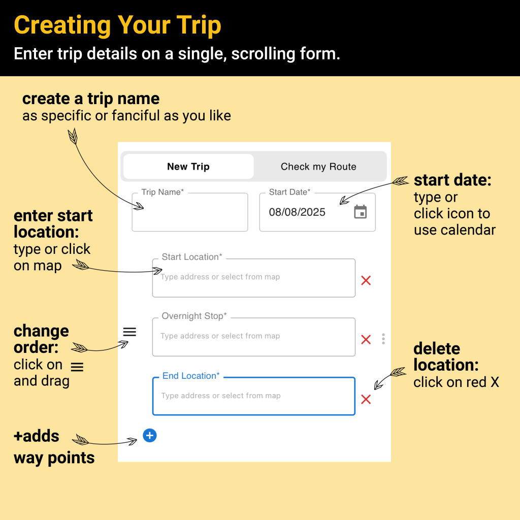
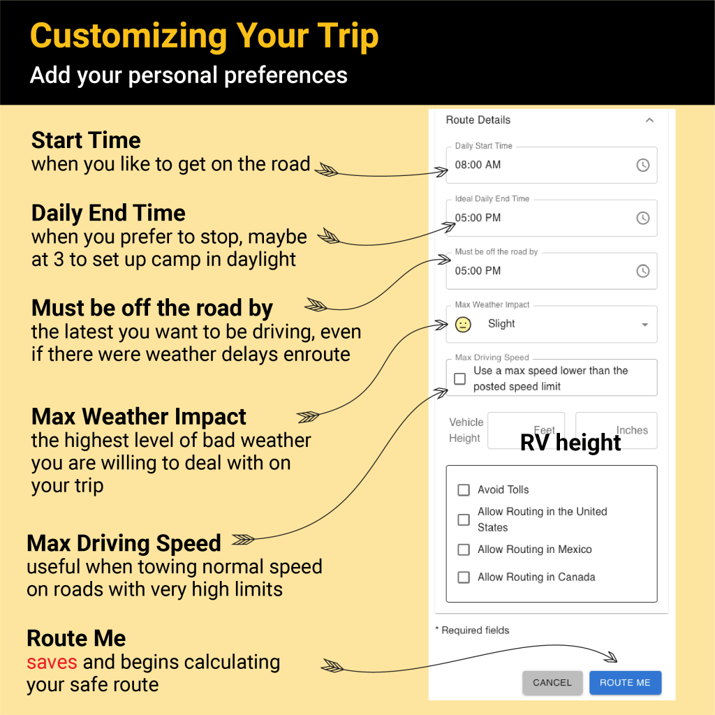
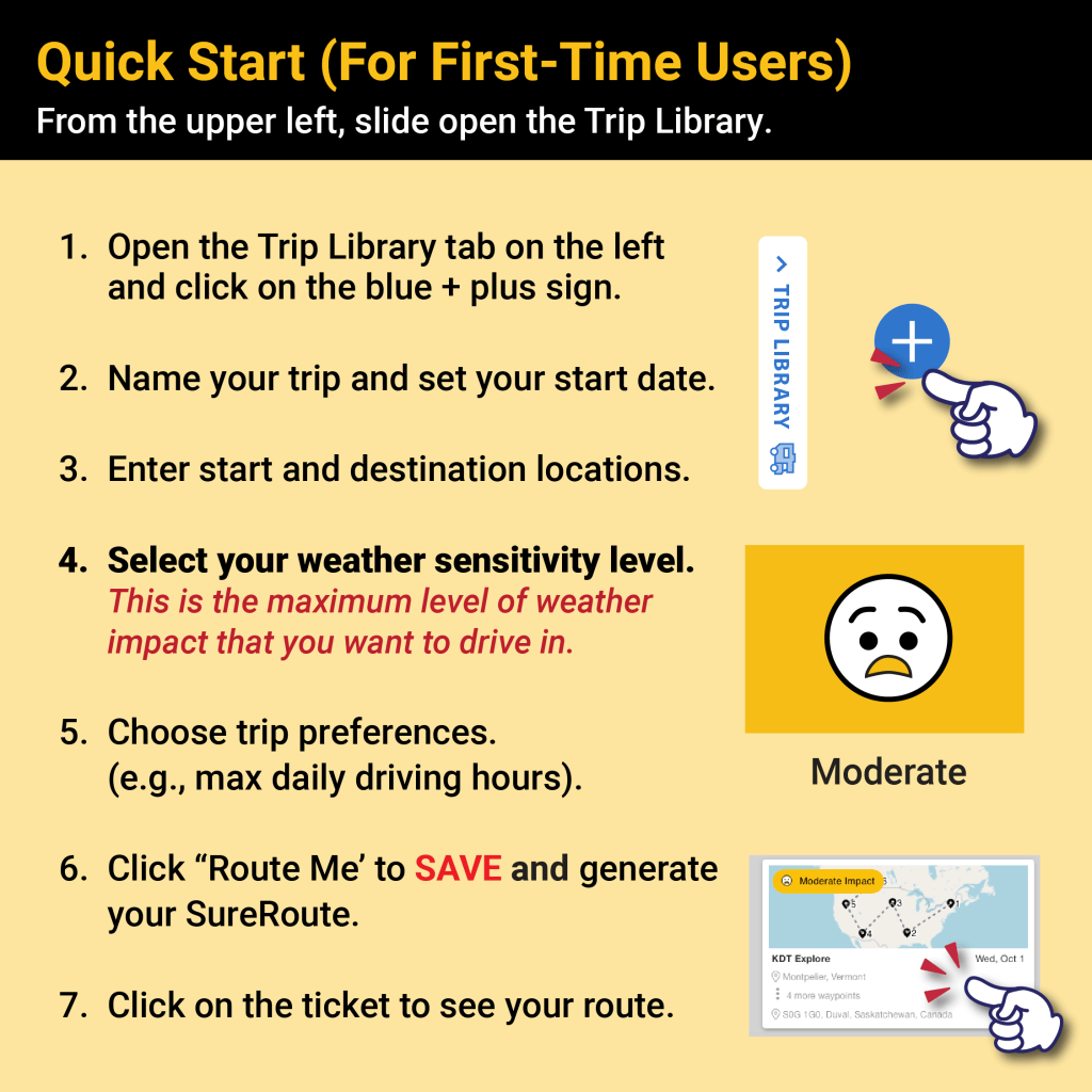
A user interface mockup showing a form for planning a trip. It includes fields to enter a trip name, start location, start date, overnight stop, and end location, with icons for actions like adding waypoints and deleting locations.
Screenshot showing 'Hudson's Bay Start' feature for planning a custom departure time for RV trips.
Screenshot of the SureRoute® user interface, showing fields to enter trip details such as start location, overnight stop, and end location, with a section highlighting how to adjust the number of overnights.
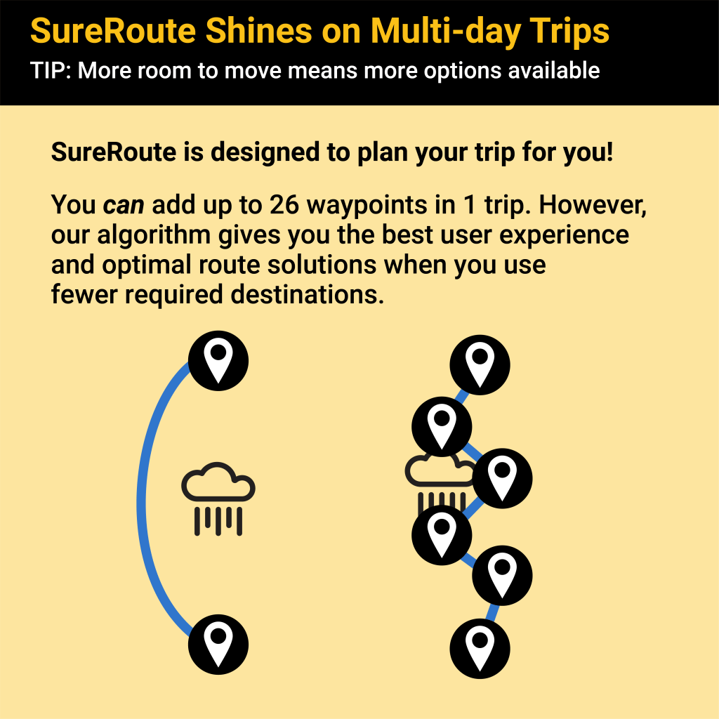
An infographic explaining SureRoute's multi-day trip planning capabilities, featuring a map with waypoints and weather icons, and tips on using fewer destinations for optimal routes.
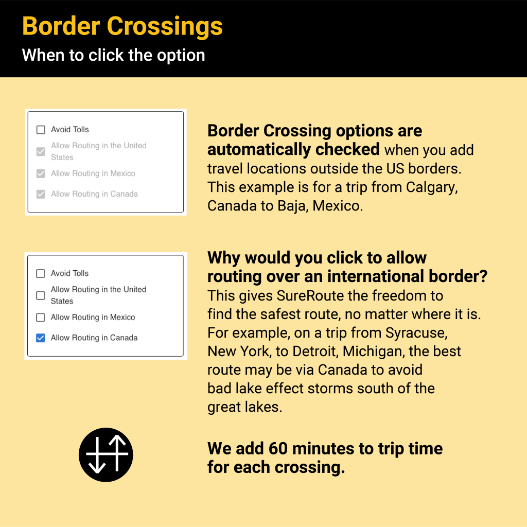
Image illustrating border crossing options in SureRoute, showing settings for routing in Canada and Mexico.
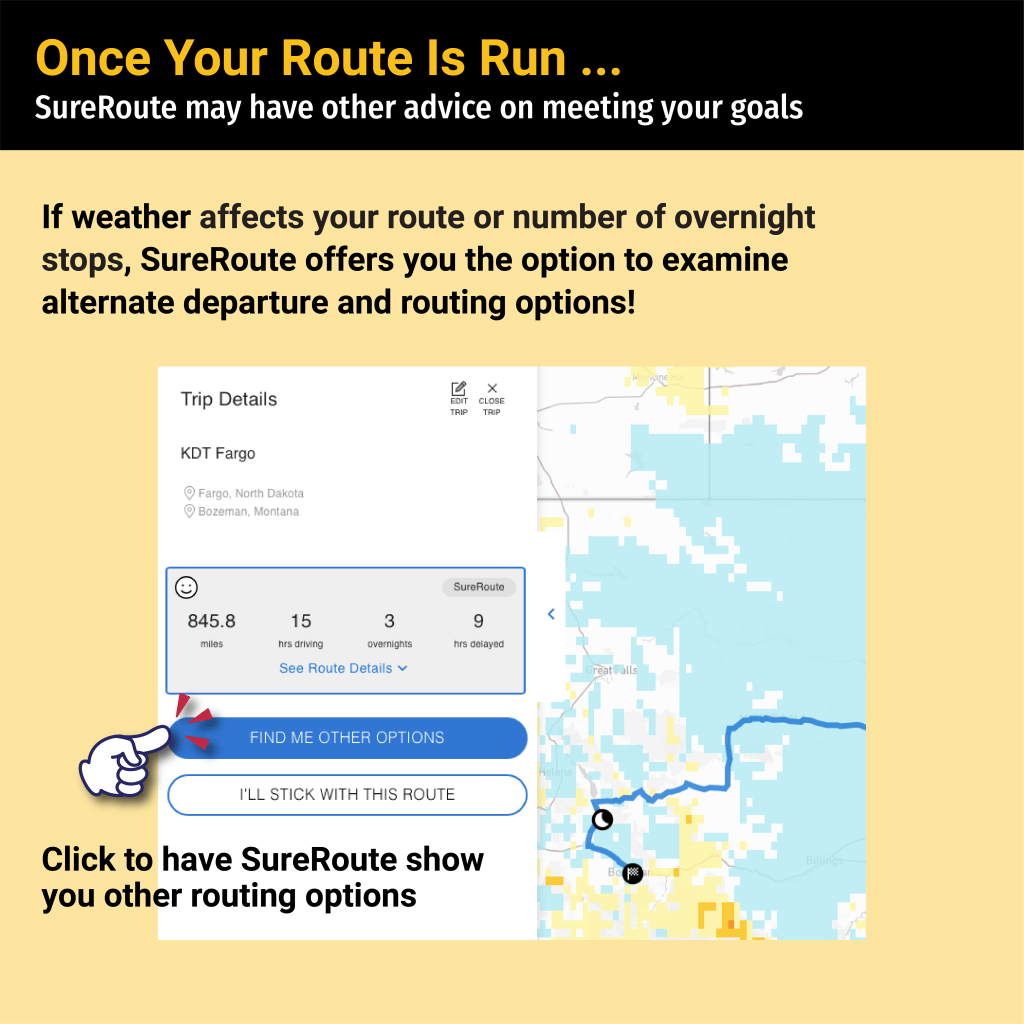
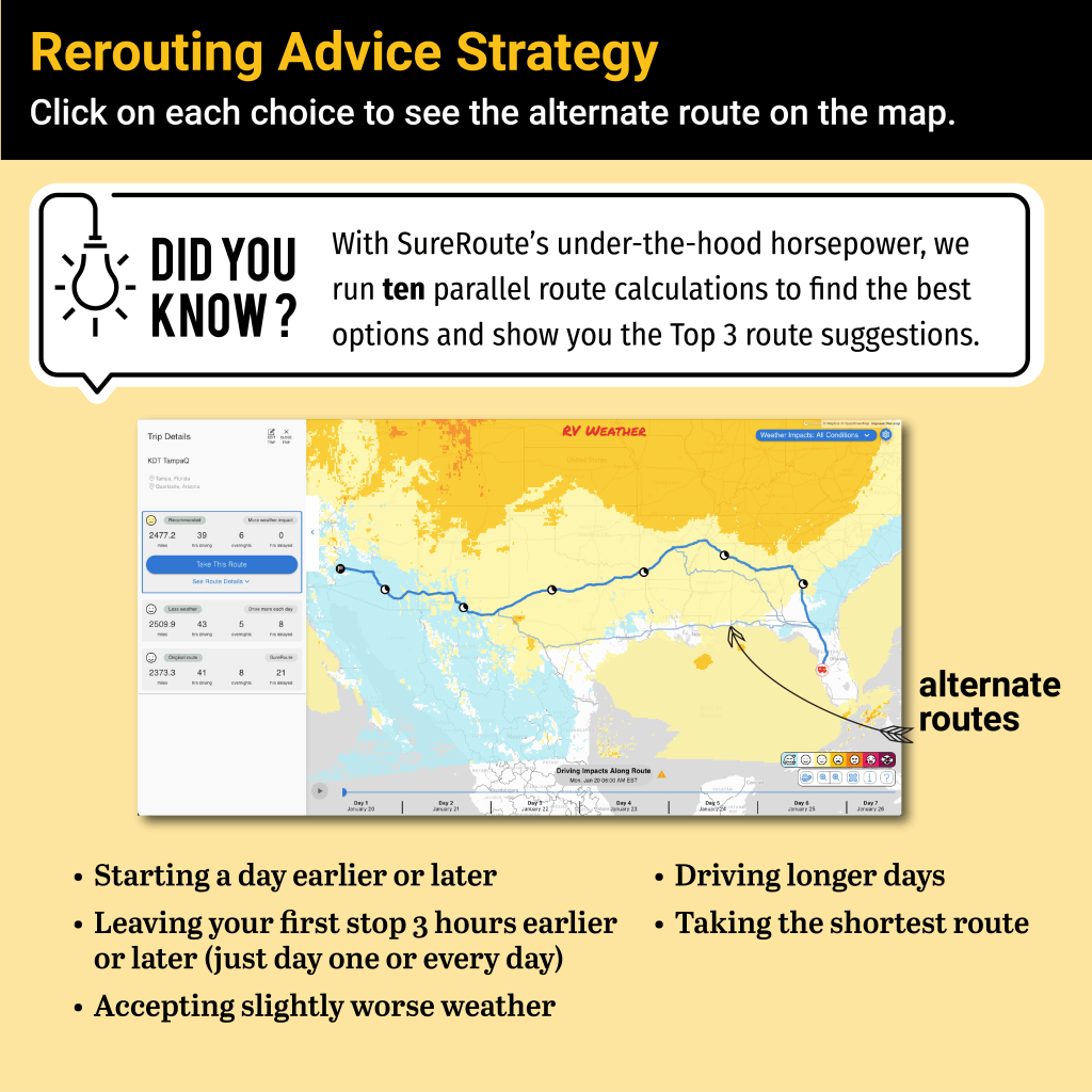
Screenshot of SureRoute® interface displaying trip details including total miles, hours, overnight stops, and a map with traffic information and options for alternative routing.
Infographic illustrating rerouting advice strategies for RV travel with SureRoute, highlighting top suggestions for optimizing routes based on various factors.
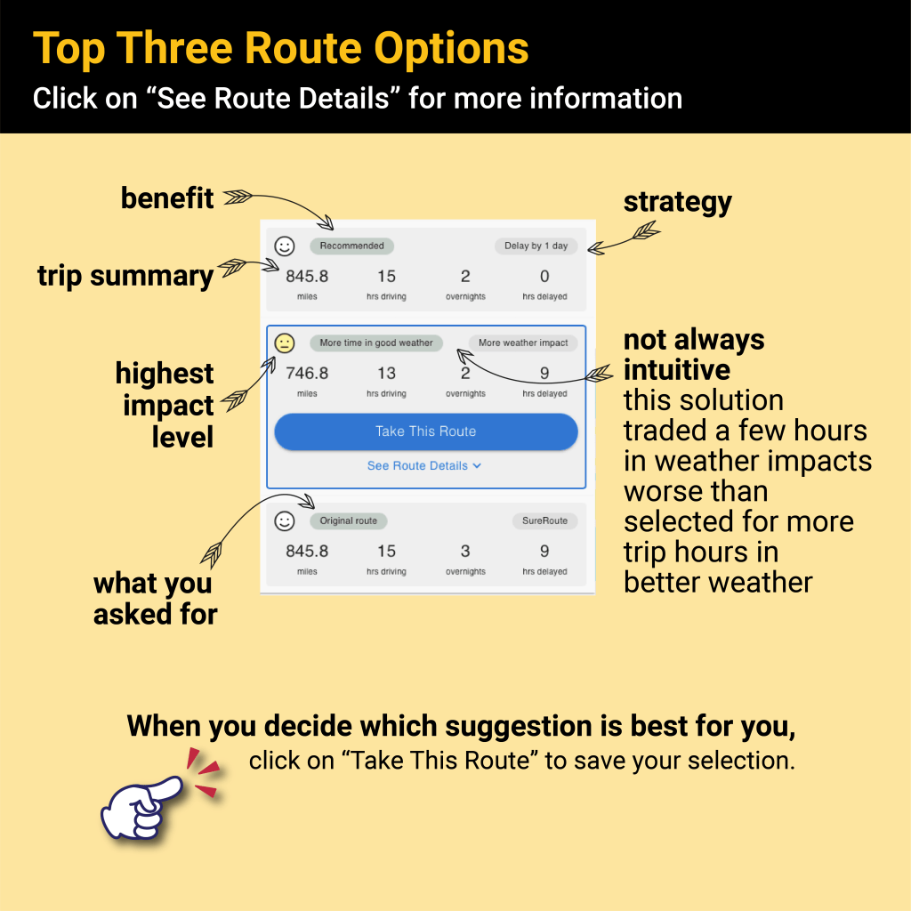
A graphic displaying the top three route options for RV planning with information on trip distance, driving hours, overnight stays, and delays, including buttons for selecting routes and viewing more details.
Infographic showing metrics for choosing RV routes, highlighting trade-offs in distance, driving time, overnights, and weather impacts with visual data breakdown.
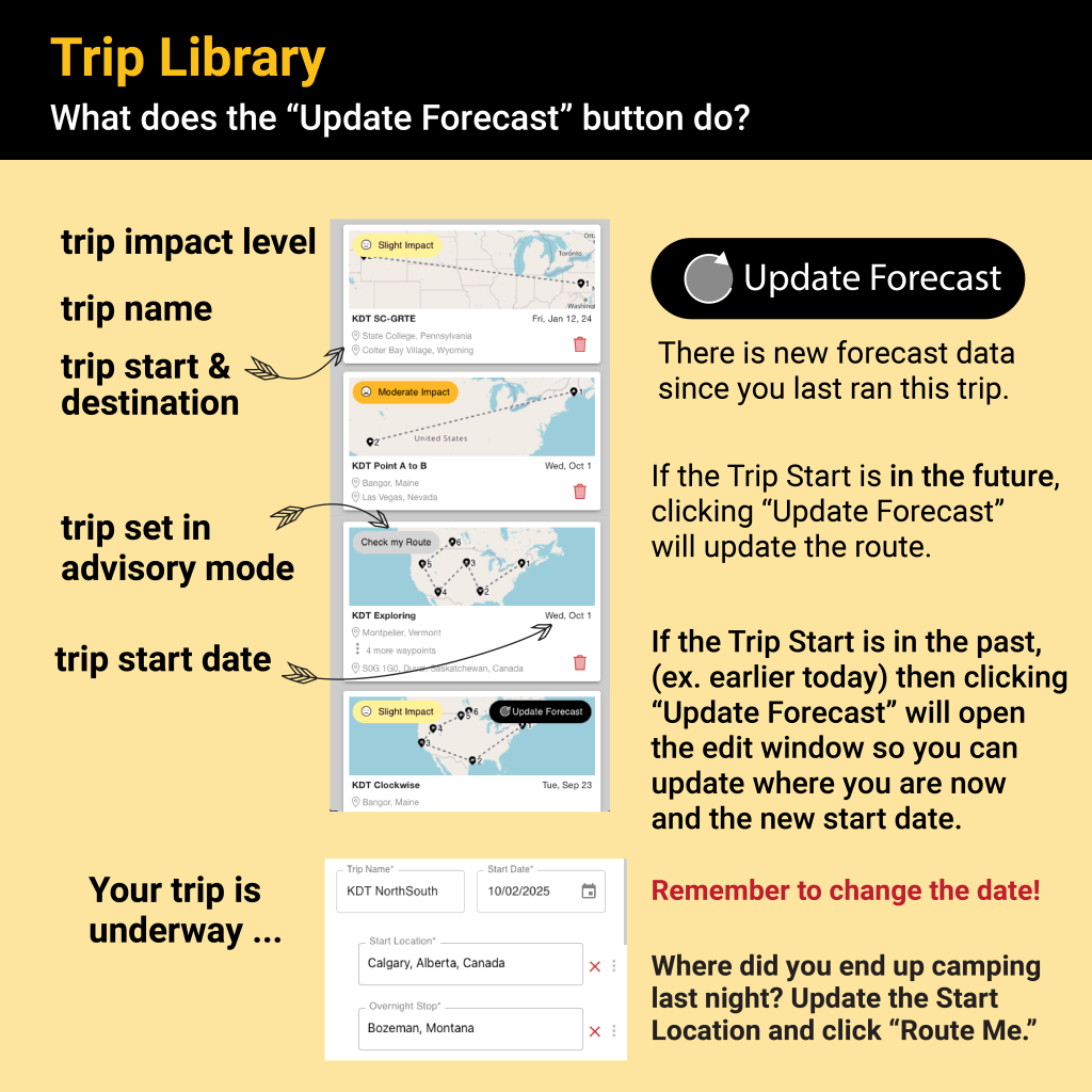
Screenshot of the SureRoute® Trip Library interface, illustrating the 'Update Forecast' button functionality for managing trip details including start date, destination, and impact level.
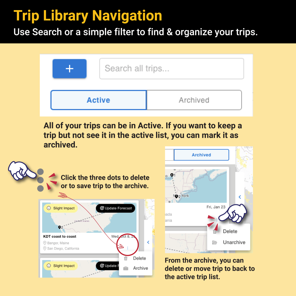
Instructional graphic showing Trip Library Navigation with options to search for trips, manage active and archived trips, and delete or save options.
Graphic displaying a trip overview with driving directions and a route map for a journey from Calgary, Alberta, to San Diego, California.
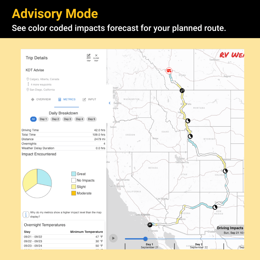
Screenshot of SureRoute® Advisory Mode showing a color-coded map indicating weather impacts for a planned road trip itinerary from Calgary to San Diego with driving details.
Screenshot of the SureRoute® interface showing top trip details and weather impact options for RVers. The top section features a map with driving impacts and conditions, while the bottom section provides additional routing options.
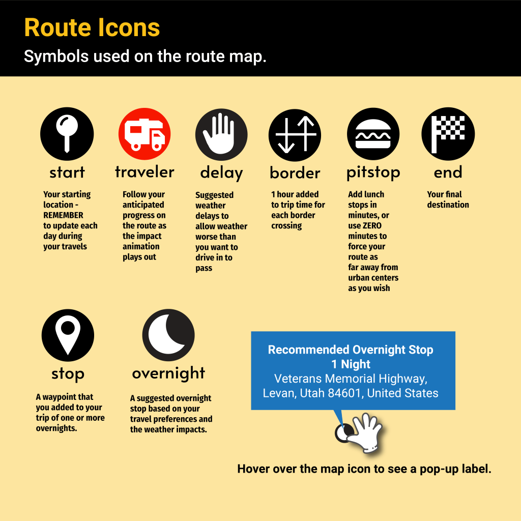
Infographic explaining route icons used on a travel map, including symbols for start, traveler progress, delays, border crossing, pit stops, and final destination.
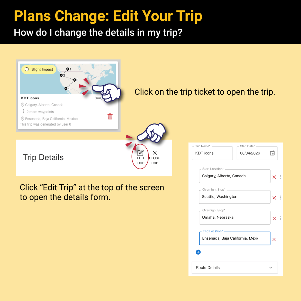
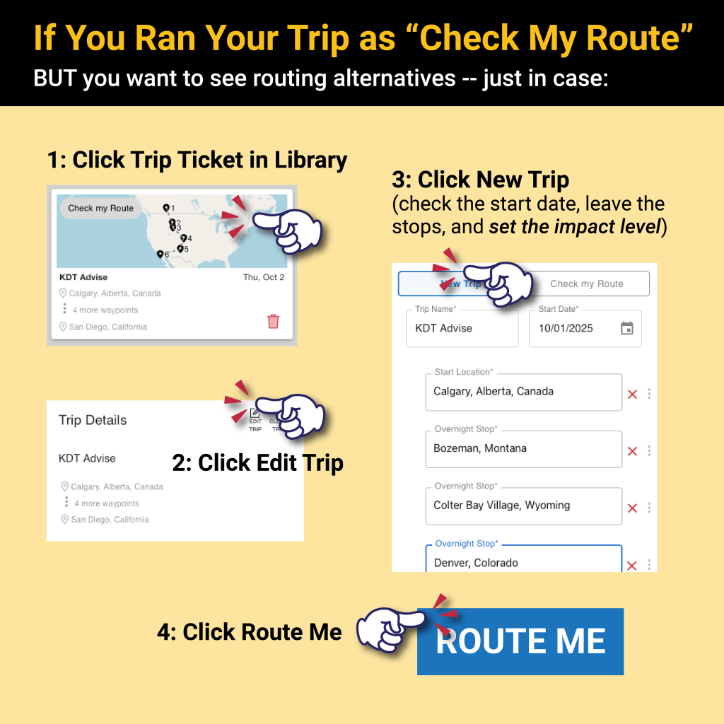
A step-by-step guide for using the 'Check My Route' feature with labeled graphics showing how to access trip details, edit trips, and view routing alternatives.
Graphic displaying SureRoute® Advisory Mode with options for weather impact levels: Challenging, Hazardous, and Treacherous, along with buttons for finding alternate routes or sticking with the current route.
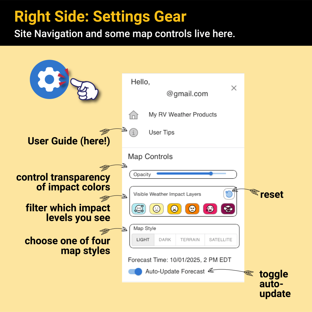
Settings interface for SureRoute® showcasing user controls for map navigation, opacity adjustment, impact filtering, map style selection, and auto-update toggle.
Graphic showing the 'Weather Impacts' map layer options in the SureRoute® application, highlighting features for filtering and viewing driving conditions based on weather.
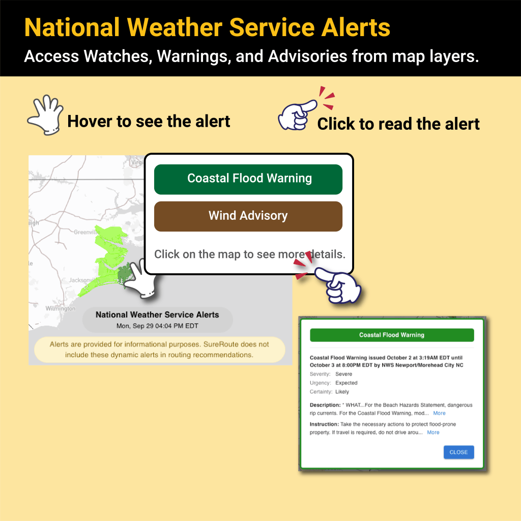
Infographic illustrating National Weather Service alerts, showing options to hover for alerts and click to read details about coastal flood warnings and wind advisories.
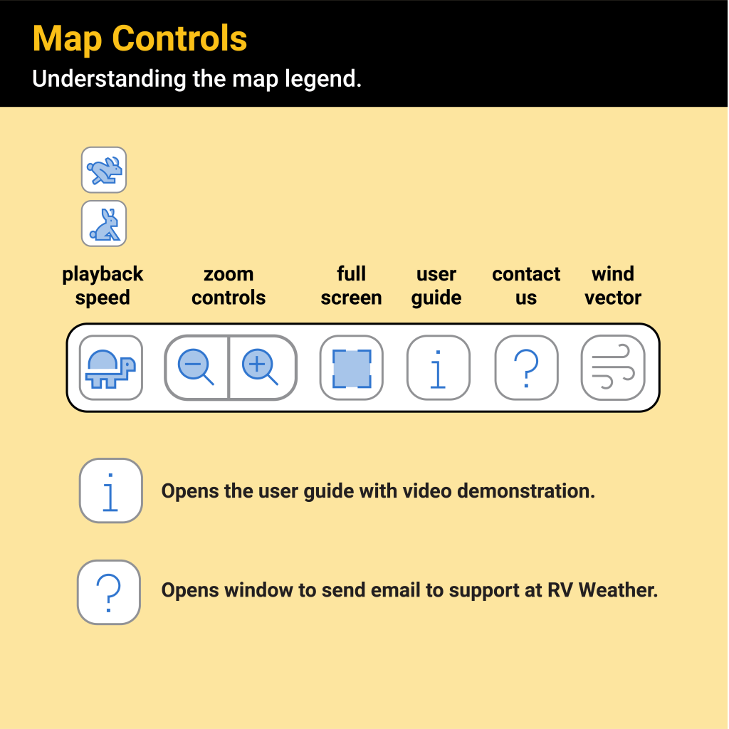
An infographic illustrating map controls including playback speed, zoom controls, fullscreen, user guide, contact support, and wind vector. Contains icons and descriptions for user interaction.
A weather map displaying wind direction and speed, highlighting areas with varying wind intensity using color-coded regions. An inset shows a zoomed view of specific geographic features and wind indicators.
Map showing wind information with tips for viewing wind gusts, highlighting the impact levels. Small arrows indicate slight impact with gusts less than 20 mph, while thicker arrows indicate higher impact levels.
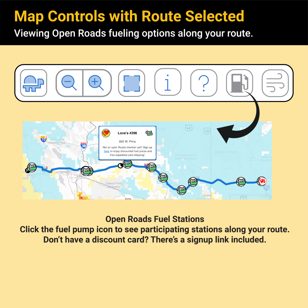
Map interface displaying route options with Open Roads fueling stations marked along the path. Includes controls for zooming and information, along with a highlighted station and a call to action for discount card registration.
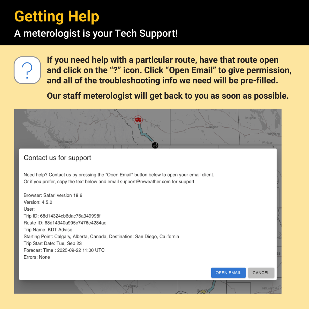
A support message from RV Weather containing troubleshooting steps for route assistance, outlining the 'Open Email' option and displaying user route details on a map.
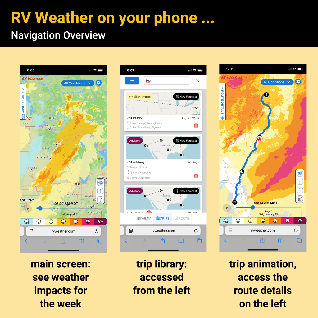
Overview of RV Weather mobile app interface showing weather impacts, trip library, and route details.
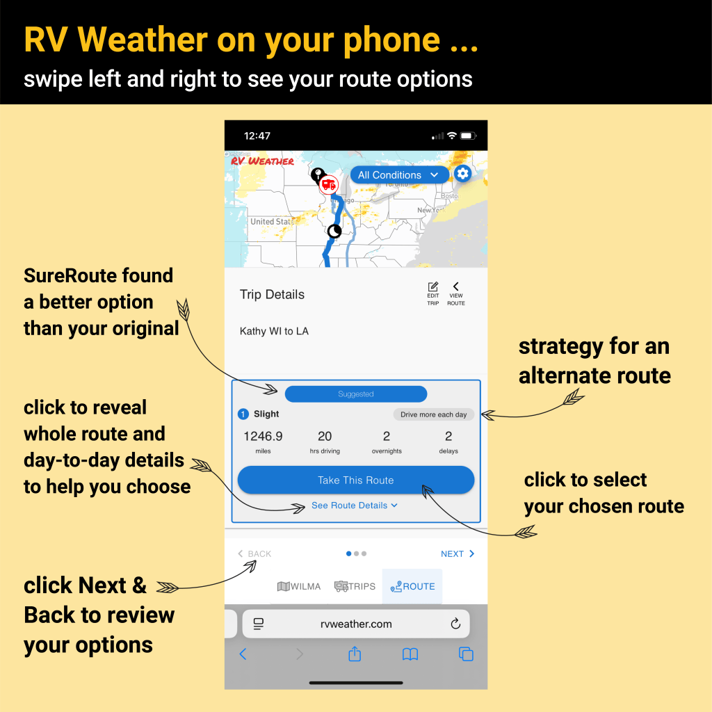
Screenshot of the RV Weather app interface showing route options and trip details. Features highlighted include route selection, driving hours, and distance.
Screenshot of the SureRoute® app displaying trip metrics for RV users. Includes driving time, total time, distance, overnights, weather delay duration, and a pie chart illustrating weather impact levels.
Screenshot of RV Weather app displaying trip details, including route and directions from Milwaukee, Wisconsin to Wichita, Kansas, along with suggested overnight stops and weather delay information.